Driving Oak Creek Canyon: Sedona's Most Scenic Road
If you only have time for one drive in Sedona, make it this one. State Route 89A north out of town climbs through Oak Creek Canyon, trading red-rock desert for a shady creek bottom and then a wall of switchbacks that hauls you up onto the rim near Flagstaff. It’s about 30 miles end to end, drivable in roughly 45 minutes without stopping, but nobody who’s paying attention actually does it without stopping.
The honest version: it’s gorgeous, and it’s also a narrow two-lane road that gets crowded, slow, and occasionally white-knuckle near the top. This guide walks you through the route stop by stop, tells you what each one costs and what pass it needs, and is straight with you about traffic, parking, and the parts where there’s nothing but air between you and the canyon floor.
What it is and why you’d drive it
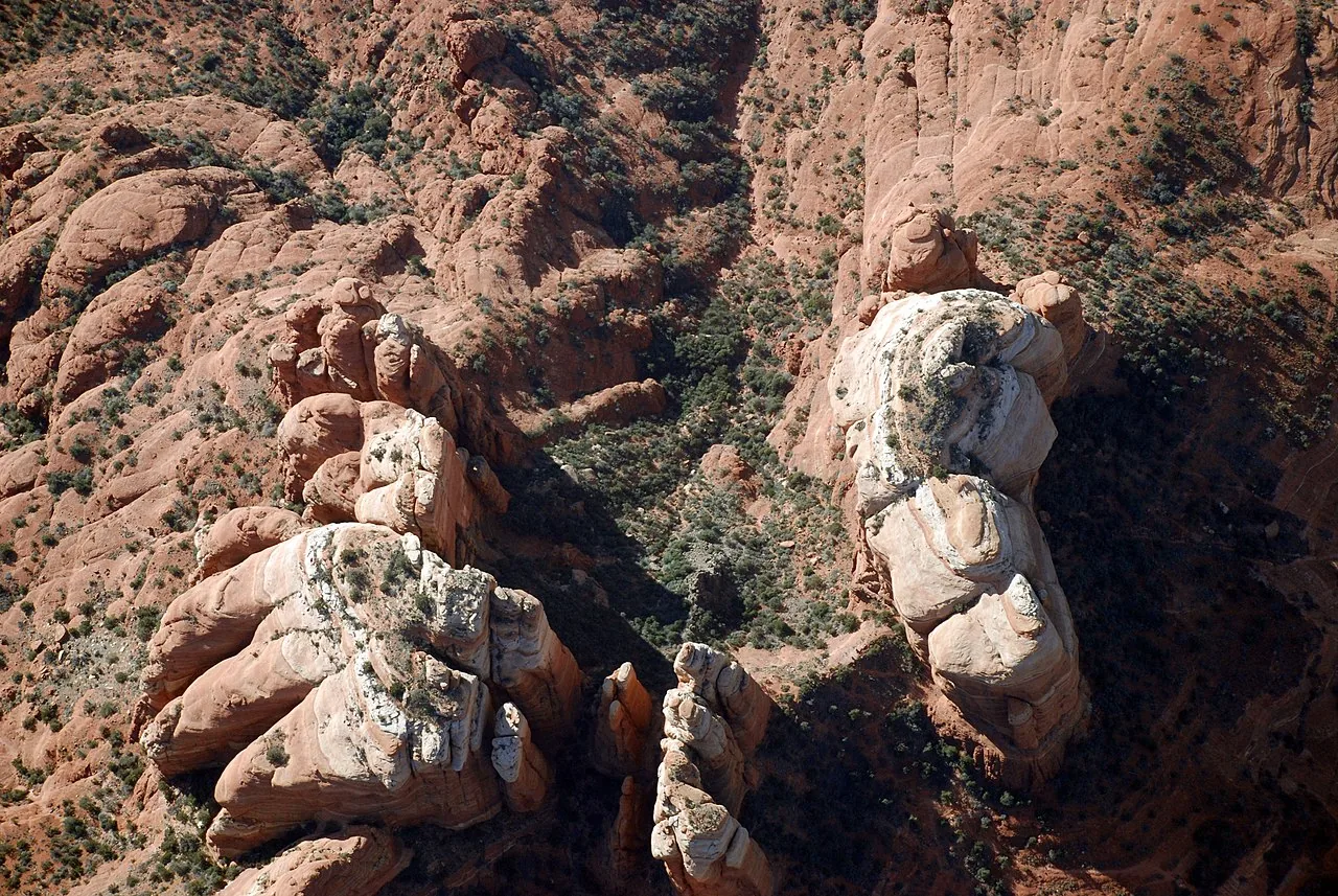
Oak Creek Canyon is the gorge that Oak Creek has cut into the southern edge of the Colorado Plateau, just north of Sedona. SR 89A runs right up the middle of it. The most celebrated stretch is the roughly 15-mile section between Sedona and the canyon rim, which the U.S. Forest Service recognizes as a scenic drive; the full run from Sedona’s edge to Flagstaff is closer to 30 miles.
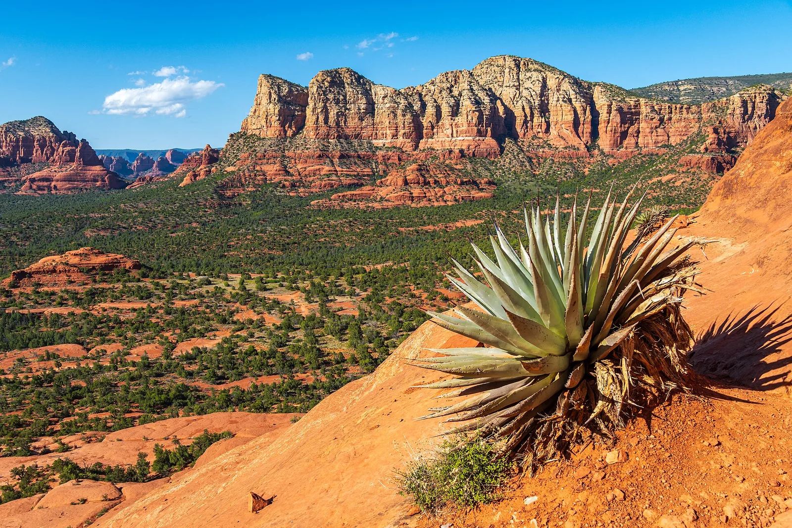
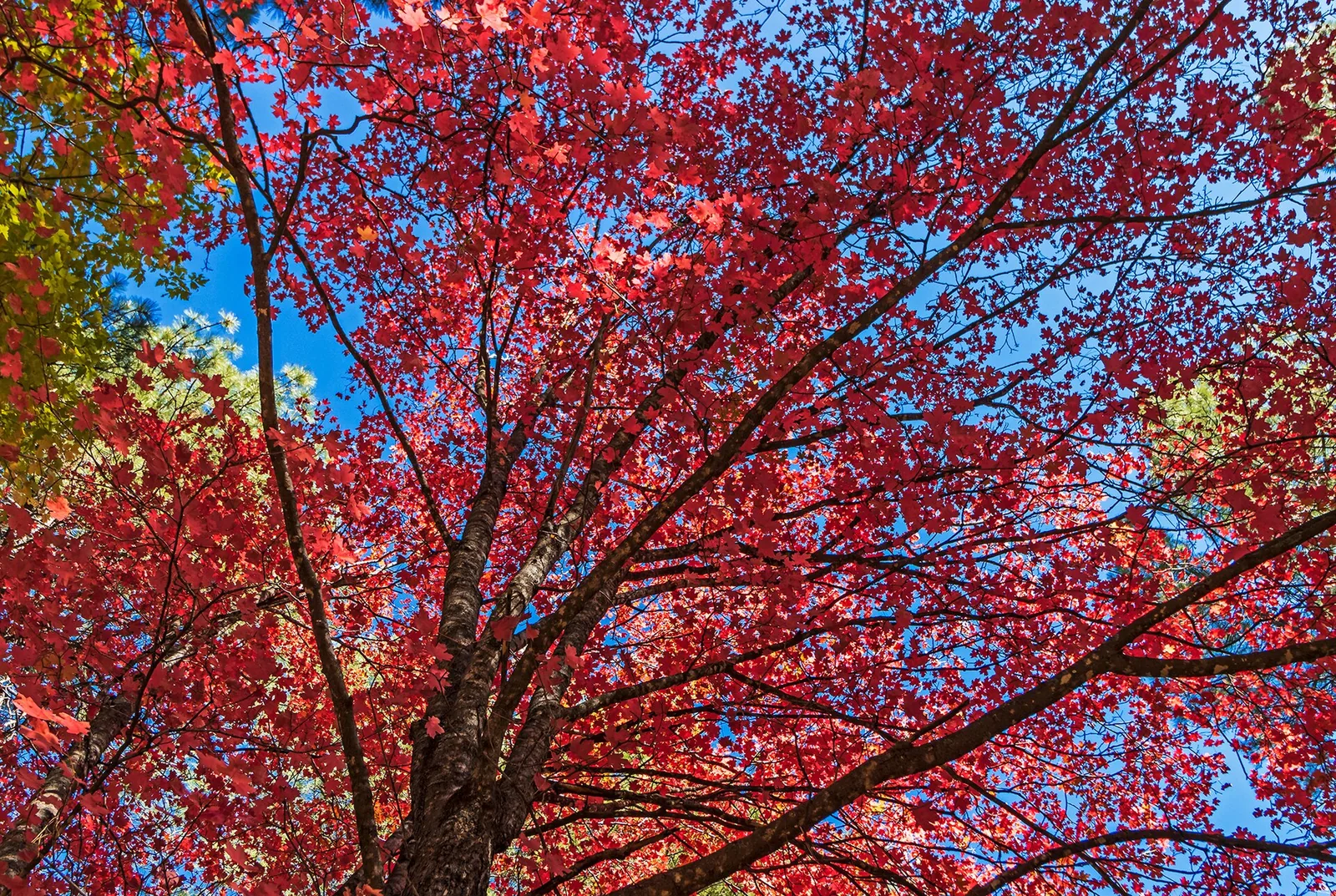
What makes it special is the change. You start among Sedona’s red sandstone in high-desert scrub, drop down alongside the creek into a corridor of sycamores, cottonwoods, maples, oaks, and tall pines, and then climb roughly 2,000-plus feet up a set of switchbacks to the rim at around 6,400 feet. In about 45 minutes of driving you pass through several different ecosystems. In October the deciduous trees along the creek light up gold and red against the canyon walls, which is the single best reason to time a trip around this drive.
A few reasons to actually do it:
- It’s free to simply drive through. No pass is required to use the highway itself.
- Many of Sedona’s best swimming holes, picnic spots, and hiking trailheads hang off this one road.
- It’s a genuinely different experience from the open red-rock vistas elsewhere around town. This is shade, water, and forest.
- The view back down the canyon from Oak Creek Vista at the top is one of the most photographed in Arizona, and it’s a five-minute walk from your car.
How to drive it: direction, time, and the basic plan
The canyon runs roughly north-south, with Sedona at the bottom (south) and Flagstaff at the top (north). You can drive it either way.
Sedona to Flagstaff (uphill): You ease into it. You follow the creek for miles through the forested section, passing most of the stops, and save the switchbacks and the big rim view for last. This is the better direction if you want the dramatic climb as a finale.
Flagstaff to Sedona (downhill): You hit Oak Creek Vista first, then descend the switchbacks with the canyon opening up in front of you, and finish among the red rocks dropping into town. Many people prefer this direction for photography because you’re driving toward the most colorful scenery and the light is often kinder in the afternoon as you come down into Sedona.
There’s no wrong answer. If you’re staying in Sedona and just want the drive, a common plan is to head up, stop at Oak Creek Vista, maybe continue a few minutes to where the forest opens up, then turn around and come back. You don’t have to drive all the way to Flagstaff to get the payoff.
How long to budget
| Plan | Rough time |
|---|---|
| Straight through, no stops | ~45 minutes one way |
| A couple of quick photo stops | ~1.5 hours one way |
| Half-day with a hike or Slide Rock | 4 to 6 hours |
| Full day, multiple stops both ways | The whole day, easily |
That table assumes normal traffic. On a busy fall weekend or a summer afternoon, add a lot. The two-lane road has no real passing lanes through the canyon, so one slow RV or a packed parking lot at Slide Rock can back things up for a long way.
Do I need a pass?
This trips a lot of people up, so here’s the straight version. Driving the highway is free. You only pay when you stop and park at certain sites, and different sites use different passes.
- Forest Service trailheads and pullouts (Midgley Bridge, for example) take the Red Rock Pass: about $5 a day, $15 a week, or $20 a year. The federal America the Beautiful pass ($80/year) is accepted at most of these too.
- West Fork / Call of the Canyon is run by a concessionaire and charges its own fee (commonly around $12 to $15 per vehicle). The standard Red Rock Pass and America the Beautiful are not accepted there. A Coconino Annual Pass does cover it.
- Slide Rock State Park is a state park with its own entry fee (recently around $20 per vehicle in peak season, less in winter). No Forest Service pass works here.
- Oak Creek Vista at the top has free parking.
Local tip: If you plan to hit two or more Forest Service trailheads on this trip, just buy the weekly Red Rock Pass. It’s cheaper than two day passes and saves you fumbling at a kiosk at every stop. You can buy passes online at Recreation.gov, at the Red Rock Visitor Center, the Sedona Chamber, or at the self-pay machines at the trailheads. Prices change, so confirm the current amount before you go.
The stops, in order, heading north
Here’s the route from Sedona up to the rim, with what to expect at each stop. Mile markers are approximate.
Midgley Bridge (about 2 miles north of the SR 179 junction)
Just a couple of miles out of uptown Sedona, the road crosses Midgley Bridge, a steel arch span over Wilson Canyon. There’s a parking area on the north end (a Red Rock Pass or America the Beautiful is required to park here). It’s a quick stop with a big view, and it’s the trailhead for several hikes, including the Huckaby Trail, Wilson Canyon, and the steep climb up Wilson Mountain. The lot is small and popular, so it fills fast on weekends. Even if you don’t hike, it’s worth pulling in for the view down into the canyon and back toward the red rocks.
Indian Gardens (about 4 miles north)
A few miles up, Indian Gardens Cafe & Market is the spot to grab breakfast, a sandwich, or coffee before you head deeper into the canyon. It’s a historic general store and cafe, in operation since 1947 and often called the oldest continuously operating store in the Sedona area. Order at the counter, then sit out on the shaded back garden patio along the creek. It’s a relaxed, slightly rustic place. Hours are typically morning through late afternoon, with a pizza night on Fridays. This is the easiest place on the drive to pick up picnic provisions if you’re headed for a swimming hole or trailhead.
Slide Rock State Park (about 7 miles north)
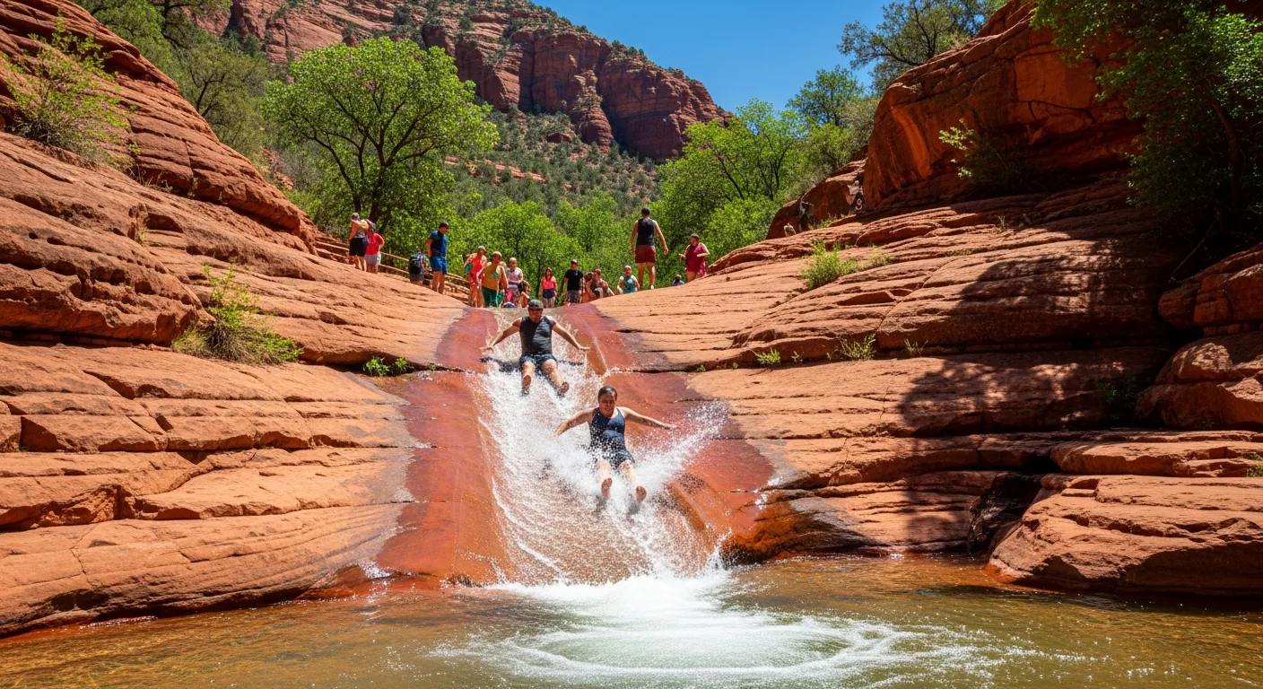
This is the famous one: a natural rock waterslide where Oak Creek has worn a smooth chute into the sandstone, and on a hot day you can slide down it into the pools. It started as an apple farm, and the historic orchard and homestead are still there. It is genuinely fun and genuinely crowded. In summer the parking lot regularly fills by mid-morning and the park sometimes closes its gates until cars leave. Plan to arrive early (right at opening) or come in the late afternoon.
A few honest notes on Slide Rock:
- Entry is a per-vehicle fee, recently around $20 in peak season and less in winter. Confirm current pricing and hours before you go, since both change seasonally.
- The rock is slick and the water is cold even in summer. Wear old shoes or water shoes; the chute will shred a swimsuit, so bring something you don’t love.
- Pets are restricted in the swim area during the warm months. Don’t bring the dog expecting to bring it down to the creek.
- Last entry is usually about an hour before closing.
We’ve got a deeper write-up if Slide Rock is your main goal: see the Slide Rock guide.
Junipine and the canyon lodges (about 8 to 9 miles north)
Past Slide Rock the canyon narrows and gets greener. Junipine Resort sits creekside here, and its restaurant, The Table at Junipine, is a pleasant lunch or dinner stop with a canyon setting if you’d rather sit down than picnic. Reservations are smart in season. There are a handful of small lodges and creek houses tucked along this stretch; it’s the quietest, leafiest part of the drive.
West Fork / Call of the Canyon (about 10 to 11 miles north)
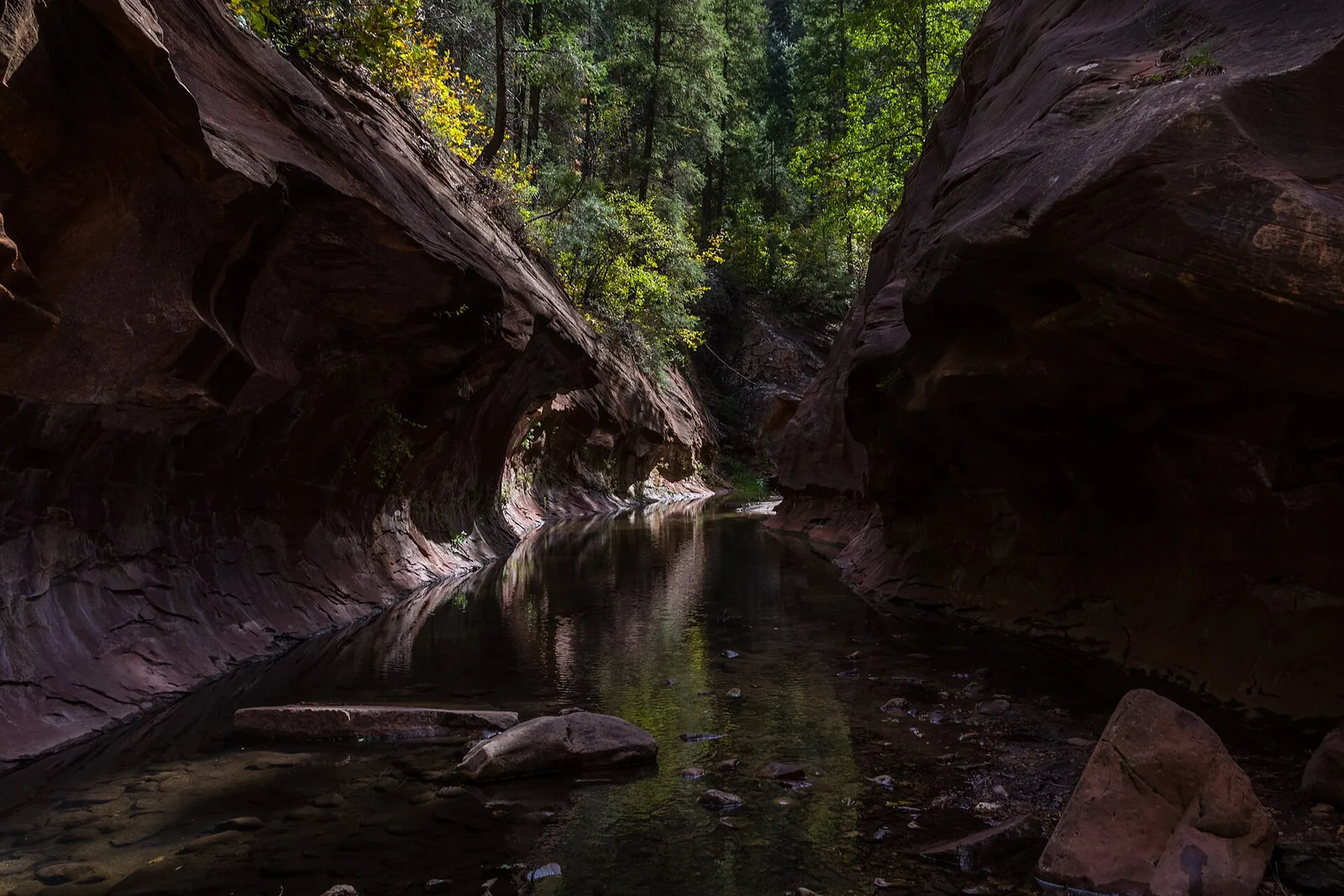
If you do one hike on this drive, make it West Fork. The trailhead is at the Call of the Canyon day-use area, and the trail follows a side canyon of Oak Creek that narrows between tall walls. It’s roughly 6.5 miles round-trip with a gentle grade but more than a dozen creek crossings, so expect wet feet. In late October it’s arguably the best fall-color hike in Arizona, which also means it’s mobbed; the lot often fills by mid-morning in October.
Remember this one has its own fee and does not take the Red Rock Pass. Full details, including timing and parking strategy, are in the West Fork Trail guide.
The switchbacks and Oak Creek Vista (the top, about 13 to 15 miles north)
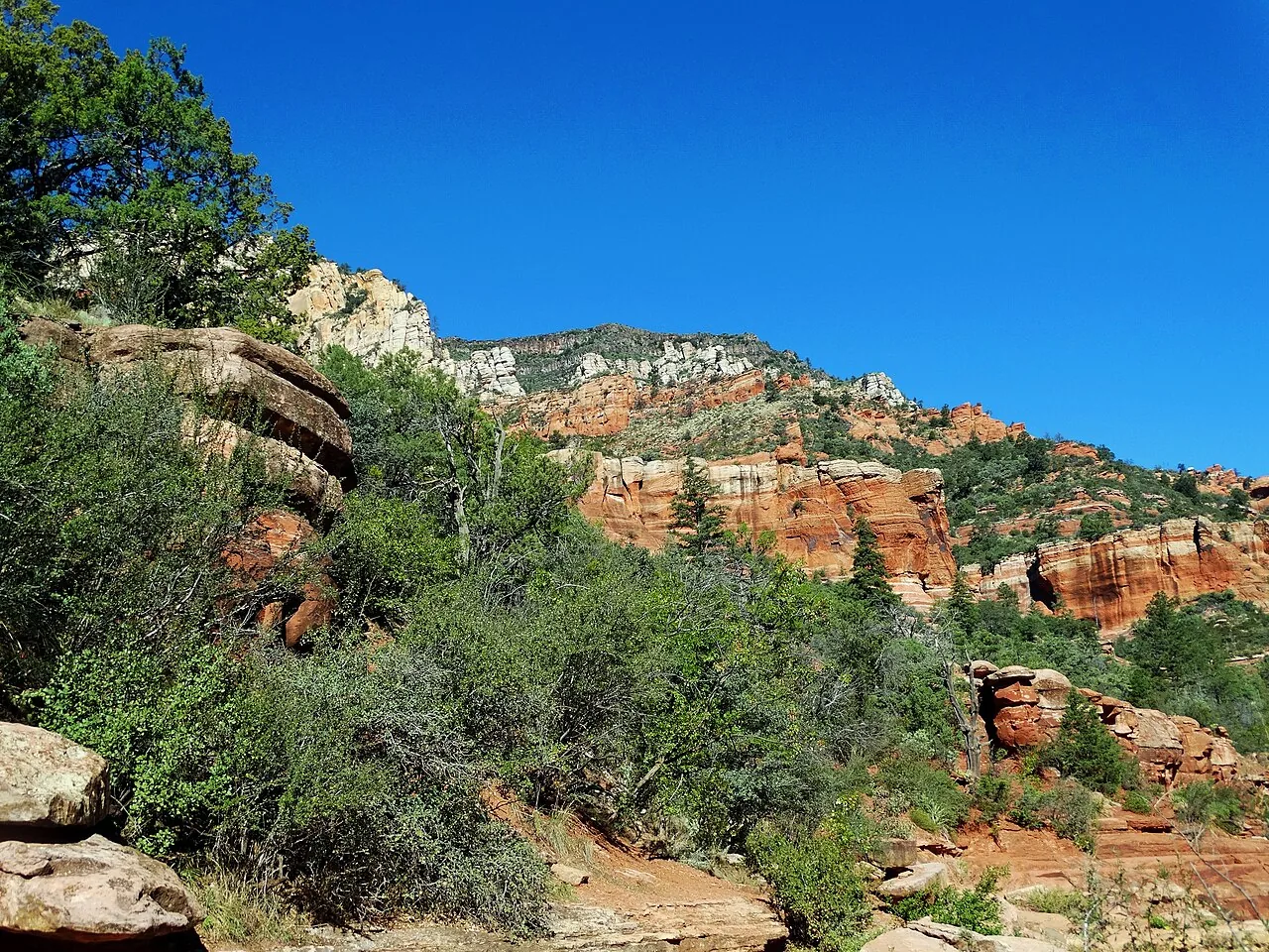
Near the head of the canyon, the road leaves the creek and starts climbing the canyon wall in a series of tight switchbacks. This is the dramatic part: you gain a couple thousand feet quickly, the curves are sharp, and in places there’s little or no guardrail between the road and a long drop. Take it slow, use the pullouts to let faster traffic by, and keep your eyes on the road, not the view, while you’re driving it.
At the top, on the right (east) side as you head north, is Oak Creek Vista, a free overlook on the canyon rim at around 6,400 feet. From here you look back down the length of the canyon you just climbed, with the forested gorge dropping away below and the rim cliffs framing it. There are restrooms, a visitor information stand, and a small market of Native American artisans (members of local tribes) selling jewelry, pottery, and crafts. It’s a worthwhile stop and an easy walk from the parking lot. From here it’s another roughly 15 miles of pine forest into Flagstaff.
Best time of day and season
Time of day. Mornings are calmest. Crowds and parking pressure build through the day, peaking in the afternoon, especially at Slide Rock and West Fork. The light in the canyon is tricky because the walls are tall; midday gives you the most even light on the canyon floor, while early and late hours leave parts of the canyon in shadow. For the view from Oak Creek Vista back down the canyon, afternoon and evening light is generally warmer and more flattering.
Season. Each season has a different character:
- Fall (mid-October to early November): The headline season. Maples, oaks, sycamores, and cottonwoods turn gold and red along the creek. Peak shifts a week or two each year with the weather. It is also the single most crowded time; weekends are packed and parking is brutal.
- Summer (June to August): Hot in Sedona but noticeably cooler in the shady canyon, which is exactly why Slide Rock and the swimming holes are jammed. Expect full lots by mid-morning and afternoon monsoon thunderstorms that can bring sudden downpours and flash-flood risk in the side canyons.
- Spring (March to May): Green, with high water in the creek and wildflowers. A lovely, less-mobbed time, though spring breaks bring spikes.
- Winter (December to February): Quietest, and beautiful when snow dusts the rim. But the top of the drive sits high enough to get real snow and ice, the road can close or require chains, and Slide Rock runs reduced winter hours. Check road conditions before heading up.
Driving safety: the honest cautions
This is a beautiful road and a demanding one. The scenery is the whole point, which is also the problem: people drive it staring out the window.
- It’s a narrow two-lane road with no passing lanes through the canyon. If you’re the one going slow to sightsee, use the pullouts to let traffic pass. If you’re behind a slow car or RV, be patient; there’s nowhere safe to pass for miles.
- The switchbacks near the top are tight and steep, with limited or no guardrails in places. Slow down, especially if the road is wet, icy, or you’re not used to mountain driving. Keep the driver focused on the road and let passengers do the gawking.
- Motorcyclists love this road. Expect groups of them, especially on weekends, and watch for bikes coming around blind curves.
- Wildlife crosses the road, particularly deer and elk near the wooded sections at dawn and dusk. Watch your speed in low light.
- Cell service is spotty to nonexistent in much of the canyon. Download your map and directions before you go.
- Monsoon season (roughly July to September) brings flash floods. Never wade into the creek or a side canyon if storms are around, even if it’s sunny where you are; water rises fast and from upstream.
- Watch for pedestrians near the trailheads and swimming holes, where people park along the road and cross to reach the creek.
How to avoid the crowds
The drive is most pleasant when it isn’t bumper to bumper. A few things that actually help:
- Go early. Being at Slide Rock or West Fork right at opening (or before) is the single biggest difference-maker. Mid-morning is when lots fill.
- Go midweek. Weekends, holidays, and peak fall weekends are the worst. A Tuesday in fall beats a Saturday by a mile.
- Reverse the timing. If you can’t go early, go late. Many day-trippers clear out in the afternoon, and the late-day light is lovely.
- Skip Slide Rock parking entirely on peak days. If you mainly want the drive and the views, you can enjoy the canyon without fighting for a spot at the busiest sites.
- Don’t try to do it Friday or Sunday afternoon, which is when everyone is coming or going from Flagstaff and the Grand Canyon.
- Consider the shuttle for trailheads. Sedona runs seasonal shuttles to some popular trailheads, which sidesteps the parking problem at certain sites. Check the current Sedona Shuttle routes and schedule before you rely on it.
Accessibility and what to bring
Accessibility. The drive itself is accessible to anyone who can ride in a car, and that alone delivers most of the scenery. Oak Creek Vista has paved parking, restrooms, and a relatively short, mostly level path to the overlook, making it the most accessible viewpoint on the route. Slide Rock has accessible parking and restrooms, but the actual rock area is uneven and slippery, and getting down to the creek involves rough terrain. Most trailheads in the canyon involve natural, uneven ground. If mobility is a concern, plan around the overlooks and the cafe rather than the trails.
What to bring:
- Water, more than you think, especially in summer.
- Layers. The rim at the top can be 15 to 20 degrees cooler than Sedona, and shady canyon spots stay cool.
- A full tank of gas. There’s limited fuel between the towns.
- Sturdy or water shoes if you’re going to Slide Rock or doing any creek crossings.
- A swimsuit you don’t care about for Slide Rock (the rock is rough on fabric).
- Cash or a card for fees, and your pass if you have one.
- A downloaded map, since cell service drops out.
- Sun protection, even in the forest; the high elevation sun is strong.
What to pair it with nearby
The drive slots neatly into a bigger Sedona day. Some natural pairings:
- The red-rock scenic byway south of town. SR 179 (the Red Rock Scenic Byway) is the open-vista counterpart to Oak Creek Canyon’s shady gorge. Driving both gives you the full range of Sedona scenery in a day.
- A short canyon hike. West Fork is the standout, but there are gentler options too; see our roundup of easy hikes if you want something shorter.
- Slide Rock, if you’ve got kids or it’s hot. See the Slide Rock guide.
- Uptown Sedona at the south end, for a meal or shopping before or after the drive.
And when you’ve had your fill of curves, crowds, and cold creek water, there’s something to be said for heading back, drying off, and settling a friendly score on the indoor court at the house before dinner. A few rallies on the climate-controlled court beat fighting for one more parking spot. If you haven’t yet, you can stay at Pickler House and make the canyon drive a relaxed half-day instead of a rushed one.
Quick recap
Oak Creek Canyon is the easiest big payoff in Sedona: a free drive that delivers forest, water, switchbacks, and one of the state’s best overlooks in under an hour each way. Driving it costs nothing; stopping at the popular sites costs a little and, in peak season, a lot of patience. Go early or midweek, watch your speed on the switchbacks, bring layers and water, and don’t try to cram every stop into one trip. Even just the drive up to Oak Creek Vista and back is worth the morning.
Frequently asked questions
Do I need a pass to drive Oak Creek Canyon?
How long does the Oak Creek Canyon drive take?
When do the fall colors peak in Oak Creek Canyon?
Is the Oak Creek Canyon drive safe and what kind of car do I need?
Which direction is best to drive Oak Creek Canyon?
Can I just see the canyon without doing a long hike?
Stay where you can rally any season
Sedona Pickler is a private West Sedona vacation home with its own indoor, climate-controlled pickleball court — a short drive from the trailheads, viewpoints and restaurants in this Sedona guide. Play at sunrise or after dark, in any weather.
Check availability on Airbnb