The Best Easy & Family-Friendly Hikes in Sedona
Sedona has a reputation for thigh-burning scrambles up slickrock, but the truth is that some of the most rewarding red-rock scenery here sits at the end of a flat, easy walk. You do not have to chain yourself to switchbacks to stand in front of Cathedral Rock or wander a shady creek bottom. This is a roundup of the genuinely low-effort hikes around Sedona, the kind you can do with kids, with grandparents, on a hot afternoon, or on a morning when your legs are still recovering from yesterday.
A quick word of honesty up front: “easy” in Sedona still means uneven ground, full sun, and dry desert air on most trails. There are only a couple of true paved, wheelchair-friendly options, and I will flag exactly which ones those are. Everything else is easy in the sense that it is short and gentle, not in the sense that you can roll a stroller over it without a fight.
A quick comparison table
Here is the short version. Distances and elevation gains below come from Forest Service and well-traveled trail data; they are stable facts that do not change year to year. The “why go” column is my own take after a lot of time out there.
| Trail | Distance (round trip) | Elevation gain | Why go |
|---|---|---|---|
| Bell Rock Pathway | Up to ~7 mi (do any portion) | ~185 ft total | Wide, hard-packed, huge views of Bell Rock and Courthouse Butte right away |
| Fay Canyon | ~2.1 mi | ~140 ft | Shady canyon between tall red walls; cool on a warm day |
| West Fork (Oak Creek) | ~6.7 mi (turn around anytime) | ~400–800 ft, very gradual | Flat creek-bottom hike, shade and water, 13 stream crossings |
| Doe Mountain | ~1.5–2.4 mi | ~400–470 ft | Short climb to a flat mesa top with 360-degree views |
| Baldwin/Templeton at Red Rock Crossing | ~1.75–3.2 mi (loop options) | ~240 ft | Classic Cathedral Rock reflection over Oak Creek |
| Sugarloaf / Teacup | ~2 mi loop | ~290–380 ft | Quick summit, close to town, easy to combine |
| Sedona Wetlands Preserve | ~1.6 mi loop | Minimal | Flat, crushed-gravel, wheelchair-friendly bird walk |
| Posse Grounds Park paths | ~2 mi of paths | Minimal | Paved, in-town, playground, red-rock views |
| Broken Arrow to Submarine Rock (easy part) | ~3.5 mi | ~few hundred ft | Slickrock and a famous rock formation; turn back early to keep it easy |
Bell Rock Pathway: the one everybody can do
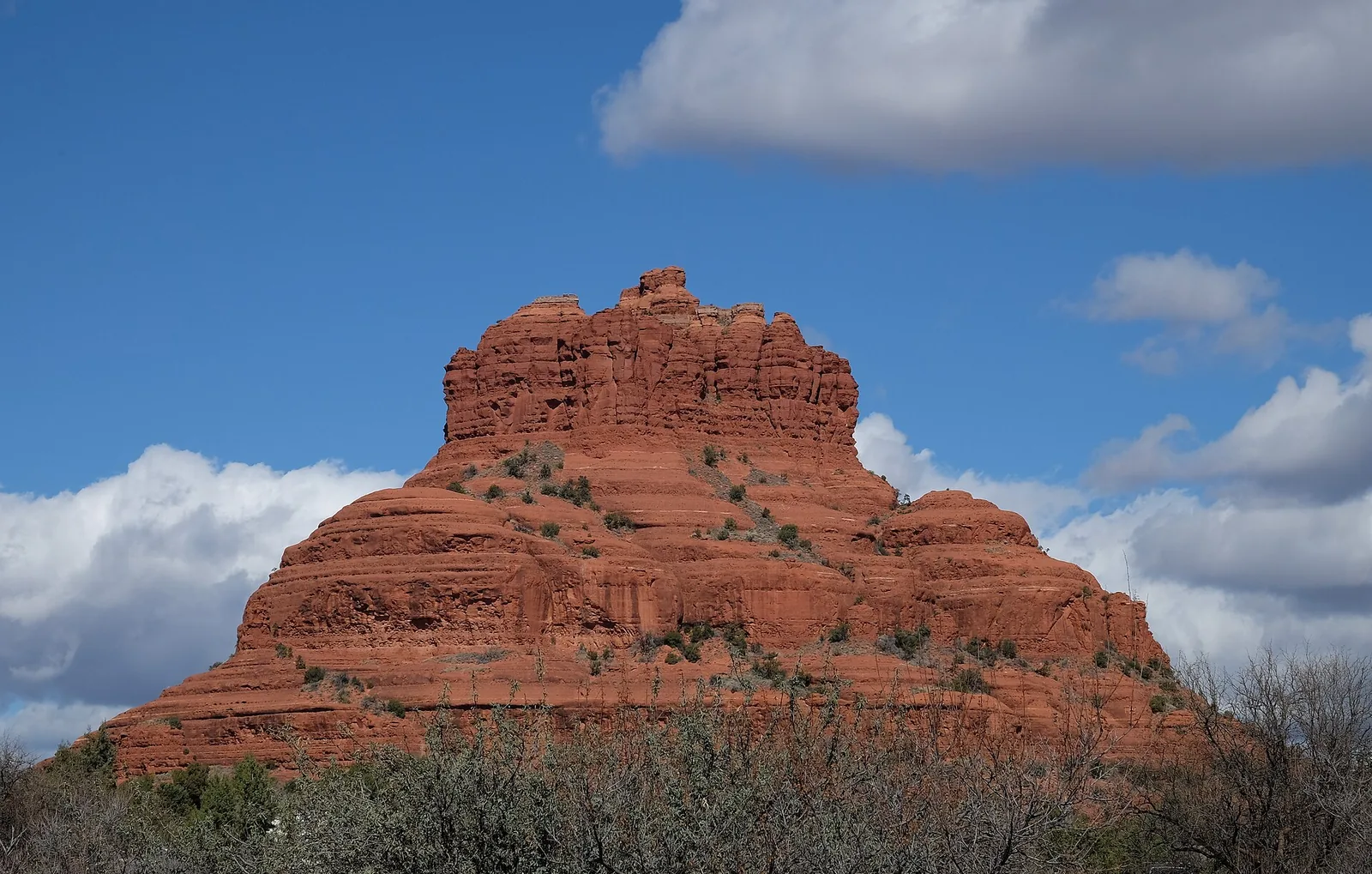
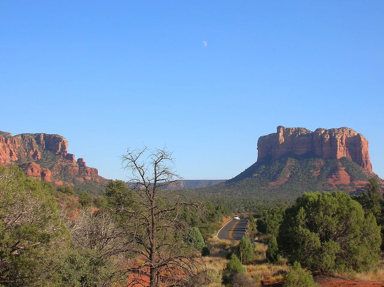
If you only do one easy hike in Sedona, make it the Bell Rock Pathway. It is wide, hard-packed, and mostly flat, with only about 185 feet of total elevation change spread over the whole thing. The full pathway runs roughly 3.5 miles one way and links three trailheads along State Route 179, so you can walk as little or as much as you like and simply turn around when you have had enough.
What it is and why go
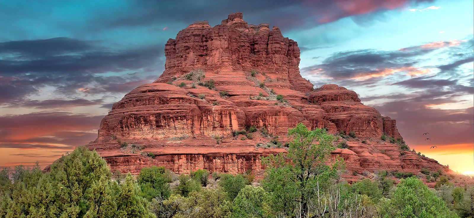
The pathway parallels the highway through the open desert south of the village of Oak Creek, and the payoff is immediate. Within a few minutes of leaving the lot you are looking straight at Bell Rock, with Courthouse Butte rising behind it and Baby Bell off to the side. There is no waiting, no climbing, no “it gets good after a mile.” It is good from step one.
How to get there and parking
There are three trailheads strung along Route 179: Bell Rock Vista, Courthouse Vista, and Little Horse. All three are paved lots, and all three require a Red Rock Pass (or a valid America the Beautiful / Interagency, Senior, or Access pass) on your dashboard. The Red Rock Pass runs about $5 a day, $15 a week, or $20 a year, sold at machines at the trailheads and at many shops around town. Confirm current pricing before you go, since fees do creep up over time.
Difficulty and what to expect
This is the rare Sedona trail you could attempt in regular sneakers. The surface is firm and smooth enough that a sturdy all-terrain stroller can handle the main pathway, though it is not technically wheelchair-rated. The one big downside is shade: there is almost none. This is a juniper-and-prickly-pear landscape, so the sun is on you the entire time.
Local tip: Start at the Bell Rock Vista (south) lot rather than the busier Courthouse Vista lot if you want a calmer start, and walk north toward Bell Rock. You get the same views with a fraction of the crowd in the first half mile.
If you want a slightly bigger day later, this same trailhead network is the gateway to the moderate Bell Rock climb and the Courthouse Butte loop.
Fay Canyon: the shady, easy canyon
Fay Canyon is my pick for the easiest hike that still feels like a real adventure. It is about 2.1 miles round trip with only around 140 feet of gentle gain, and it runs you straight up the middle of a box canyon walled in by towering red Supai sandstone.
Why go
The walls do something most Sedona trails cannot: they throw shade. On a warm spring afternoon, Fay Canyon stays noticeably cooler than the exposed trails out in the open desert, and the forest floor of manzanita and oak feels almost lush. The trail simply dead-ends at the back of the canyon against a red cliff, so it is hard to get lost.
Getting there and the pass
The trailhead is on Boynton Pass Road on the west side of town and uses the same Red Rock Pass as Bell Rock. There is a modest dirt lot that fills early on weekends.
What to expect
The main canyon floor is flat and family-friendly. There is one optional steep, rocky scramble up to a natural arch hidden in the cliffs on the right side, but you can skip it entirely and still have a complete, satisfying walk. If you are hiking with kids, treat the arch as a maybe, not a must. Fay Canyon pairs well with nearby Boynton Canyon if you want to add a longer trail the same morning.
West Fork of Oak Creek: long but flat and shady
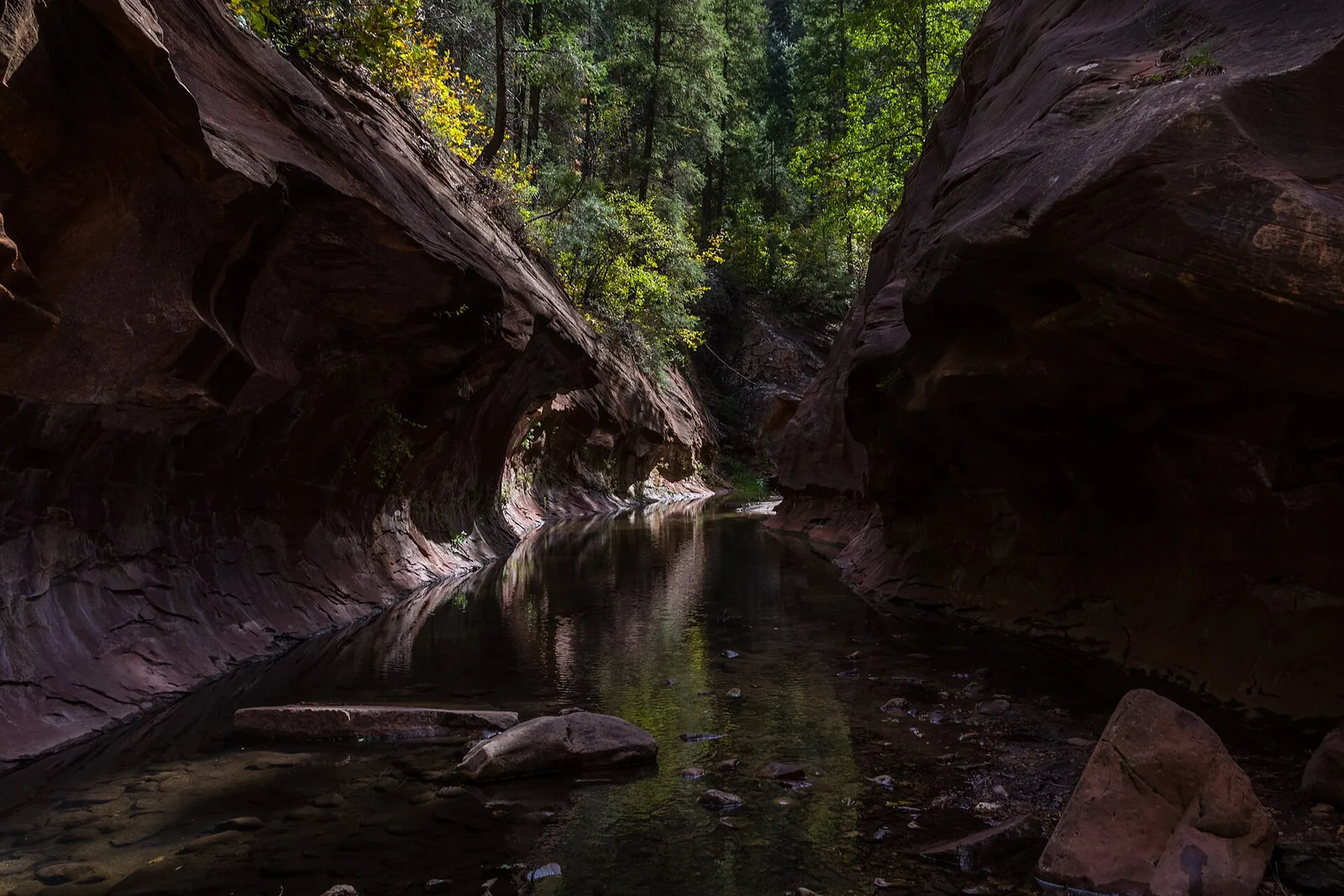
West Fork is the outlier on this list. At about 6.7 miles round trip it is not short, but it is so flat and so shaded that I include it without hesitation as one of the most family-friendly hikes in the region. The trick is that it is an out-and-back, so you simply turn around whenever you have had enough. Many people walk an hour in, have a snack by the creek, and walk back out perfectly happy.
Why go
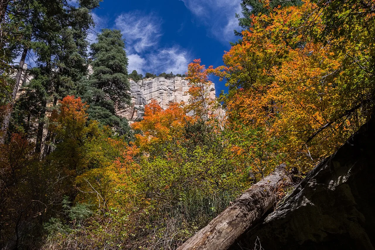
This is the green, cool, leafy hike. You walk a streambed at the bottom of Oak Creek Canyon, crossing the water on rocks and logs roughly thirteen times, under towering canyon walls and a canopy of trees. In October the maples and oaks turn, and it becomes one of the best fall-color walks in Arizona.
The fee catch (read this)
Here is the important part that trips people up: the Red Rock Pass and the America the Beautiful pass are NOT accepted at West Fork. The trailhead sits at the Call of the Canyon day-use area, which is run separately, and you pay a per-vehicle day fee at the gate. Reports of the exact amount vary (roughly $11–$15 per vehicle), and the Coconino Annual Pass (about $50) also covers it, so check the current fee before you drive up. Cash is sometimes the safest bet at the gate.
What to expect
The first three or so miles are nearly level, following the creek. You will get your feet wet or at least damp; the crossings are easy but the rocks can be slick. This is not a stroller or wheelchair trail because of the water crossings and the soft, sometimes muddy footing, but it is very doable for school-age kids who do not mind a little splashing. Read more in the dedicated West Fork guide before you commit to the full distance.
Local tip: West Fork is a victim of its own beauty. The lot fills by mid-morning, especially in peak fall color, and a line of cars waits along Route 89A to get in. Arrive at opening or come on a weekday, and never enter the creek bed if storms are building upstream in monsoon season.
Doe Mountain: the easy way to a big view
Doe Mountain is the one “summit” on this list, and it earns its place because the reward-to-effort ratio is so good. It is only about 1.5 miles round trip to the top and back (closer to 2.4 if you wander the rim once you are up there), with roughly 400 to 470 feet of gain.
Why go
Most Sedona viewpoints require either a hard climb or a drive. Doe Mountain gets you onto a genuine flat-topped mesa with 360-degree views, including a great look at neighboring Bear Mountain and out over the western red rocks, for a fraction of the work. Sunrise and sunset up here are exceptional.
Getting there and the pass
The trailhead shares a lot with Bear Mountain on Boynton Pass Road, again under the Red Rock Pass. The road in is paved most of the way with a short rough section near the lot.
Difficulty and what to expect
I will be straight with you: this is the most “moderate” of the easy hikes here. The climb up the side of the mesa is on a series of switchbacks that are gradual but steady, and the footing is rocky in places. Once you top out, though, it is flat walking on the mesa. It is not appropriate for strollers or wheelchairs. Give yourself a little extra time at the top to explore the rim, and bring more water than you think you need because there is zero shade.
If you have stronger hikers in the group, the adjacent Bear Mountain is a serious climb that starts from the same parking area, so you can split up and meet back at the car.
Baldwin and Templeton at Red Rock Crossing: Cathedral Rock without the climb
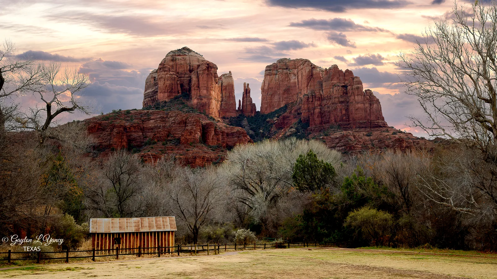
This is how you get the famous Cathedral Rock photo without doing the brutal Cathedral Rock scramble. The Baldwin Trail is a roughly 1.75-mile loop, and combining it with the Templeton Trail along Oak Creek gives you flexible options in the 3-mile range with only about 240 feet of gentle gain.
Why go
The view of Cathedral Rock reflected in Oak Creek at Red Rock Crossing is one of the most photographed scenes in the Southwest, and for good reason. From down here at creek level you get the towering spires mirrored in the water, framed by sycamores. It is also a genuine riparian zone, so it is greener and cooler than the open trails.
Getting there and the pass
There are two ways in. One is from the Baldwin Trailhead off Verde Valley School Road, which uses the Red Rock Pass. The other is from the Crescent Moon Recreation Area (Crescent Moon Ranch), which has its own separate day-use fee and is NOT covered by the Red Rock Pass, but it puts you right at the classic photo spot with restrooms and picnic tables. Pick based on whether you want the easiest photo access (Crescent Moon) or a longer trail walk (Baldwin).
What to expect
The trail itself is easy and mostly level, with some sandy and rocky sections near the creek. It connects into the broader trail network around Cathedral Rock, so it is easy to extend. If you want the full story on the iconic formation itself, see the Cathedral Rock guide. This area is also a well-known sunset spot, so expect company in the golden hour.
Sugarloaf and Teacup: quick hikes right in town
Tucked into a residential neighborhood off Highway 89A, the Sugarloaf and Teacup trails are the hikes to do when you have an hour and do not want to drive anywhere. The Sugarloaf Loop with the summit runs roughly 2 miles with about 290 to 380 feet of gain, and Teacup connects right in.
Why go
For very little effort, the short climb up Sugarloaf gives you a surprisingly broad view of Coffee Pot Rock, Thunder Mountain, and the town below. Because it is small and in-town, it rarely feels as mobbed as the marquee trails, and the trailhead has no entrance fee.
Getting there
The Sugarloaf Trailhead is at the end of a neighborhood street off Coffee Pot Drive. It is a small free lot with no pass required, which is unusual and welcome. Parking is limited, so arrive early.
What to expect
This is short but not flat; the bump up to the Sugarloaf summit is brief but rocky. The connecting Teacup Trail toward Coffee Pot Rock is gentler. Good footwear helps. There is little shade, so save it for morning or late afternoon in warm months.
The truly accessible options: Wetlands Preserve and Posse Grounds
If you need a surface a wheelchair or standard stroller can actually handle, these two are your answer. Neither is a dramatic red-rock canyon, but both are genuinely flat, well maintained, and free.
Sedona Wetlands Preserve
This is a roughly 1.6-mile loop of crushed gravel around constructed ponds, with minimal elevation change and viewing areas built to be wheelchair accessible. It is run by the City of Sedona, it is free, and it is the best bird-watching spot in the area. You will see herons, ducks, and migrating songbirds, with red rock formations on the horizon. It is quiet, easy, and a completely different flavor from the slickrock trails.
Posse Grounds Park
A couple of miles west of uptown, Posse Grounds is a city park with paved, flat paths, a large playground, restrooms, and short walking trails with real red-rock views. It is free, with no pass required. This is the place to let kids burn off energy or to take an easy walk on a day when the bigger trails feel like too much.
These two are also useful as a “rest day” plan. Walk the wetlands in the morning, let the kids hit the Posse Grounds playground, and save the legs for tomorrow. And if everyone is up for some movement that does not involve the desert sun at all, this is exactly the kind of afternoon where it makes sense to head back and settle a friendly score on the indoor court at the house.
Broken Arrow to Submarine Rock: easy if you stop early
Broken Arrow is famous as a Jeep route and as a longer hiking loop, but the first stretch on foot is genuinely easy and worth doing. The walk out to Chicken Point is about 1.5 miles each way on a good, scenic trail, and a short signed spur leads to Submarine Rock, a long whale-back of slickrock that kids love to clamber on.
Why go and how to keep it easy
The full Broken Arrow loop with all the side trips runs closer to 5 to 6 miles with real elevation, but you do not have to do that. Walk out to Submarine Rock (roughly 3.5 miles round trip total) and turn around, and you have an easy, rewarding hike on dramatic red slickrock. The key is to resist the temptation to keep going to the harder sections.
Getting there and the pass
The trailhead is at the end of Morgan Road off Route 179 and uses the Red Rock Pass. The lot is small and popular and fills early; this is also the launch point for the noisy Jeep tours, so expect engine sounds.
What to expect
Sun, slickrock, and very little shade. The footing on the slickrock is generally good but can be steep and slippery in spots, so this is not a stroller trail. Go early both for parking and to beat the heat. If you want the adrenaline version instead, this same area connects to some of Sedona’s tougher routes covered in the hard hikes guide.
Best time of day and season
Sedona’s easy trails are still desert trails, and timing matters more than fitness on most of them.
- Spring (March–May) and fall (October–November) are the sweet spot: mild days, cool mornings, and the fall maples in Oak Creek Canyon.
- Summer (June–August) gets brutally hot, with highs commonly between 95 and 105°F. On the exposed trails (Bell Rock, Doe Mountain, Broken Arrow) you genuinely need to be done hiking before about 9 a.m. or wait until after 4 p.m.
- Monsoon season (roughly July through September) brings sudden afternoon thunderstorms. These can cause flash flooding in canyons, which matters most for West Fork and any creek-bottom trail. Never be in a narrow canyon or creek bed when storms are building.
- Winter (December–February) is underrated: cool, clear, and quiet, with occasional snow that dusts the red rocks beautifully. The easy trails are usually fine, just colder and sometimes muddy.
What to bring
Even for short, easy hikes, the desert deserves respect.
- More water than feels necessary. A liter per person for a short hike, more in summer. There is no water on any of these trails except the creeks (which you should not drink untreated).
- Sun protection. Hat, sunglasses, and sunscreen. Shade is the exception, not the rule.
- Real shoes. Even easy trails have loose rock and uneven slickrock. Closed-toe shoes with grip beat sandals.
- Your Red Rock Pass or America the Beautiful pass on the dashboard, plus a bit of cash for the West Fork / Crescent Moon gates that do not take the Red Rock Pass.
- Snacks and a small first-aid kit, especially with kids.
- A downloaded map. Cell service is spotty out at the trailheads.
How to avoid the crowds
Sedona’s easy trails are popular precisely because they are easy, so they get busy. A few honest tactics:
- Go early. Most lots (Fay Canyon, Doe Mountain, Broken Arrow, West Fork) fill by mid-morning on weekends. Being at the trailhead by 7 a.m. solves most parking problems and most crowd problems at once.
- Use the free Sedona Shuttle where it runs. Several busy trailheads, including Cathedral Rock and Little Horse, have little or no parking and are best reached by the city’s free trailhead shuttle. Routes and schedules change seasonally, so check the current Sedona Shuttle schedule before you rely on it.
- Pick weekdays over weekends if your trip allows.
- Choose the quieter trailhead. For Bell Rock Pathway, the south Bell Rock Vista lot is calmer than Courthouse Vista. The Wetlands Preserve and Posse Grounds are almost never crowded.
Safety, the short version
None of these are dangerous hikes, but Sedona’s environment still catches people out.
- Heat is the number-one hazard. Heat exhaustion sneaks up fast on exposed trails. Turn around if you are not enjoying it.
- Watch the sky in monsoon season. Flash floods in canyons are deadly and arrive faster than you would believe, sometimes from rain miles away.
- Mind the footing. Slickrock is grippy when dry and treacherous when wet. Most “easy hike” injuries here are simple slips and rolled ankles.
- Wildlife. Rattlesnakes are around in the warmer months. Watch where you put your hands and feet, and keep dogs leashed.
- Tell someone your plan and carry water, even on the short ones.
Pairing your hikes with the rest of Sedona
The nice thing about easy hikes is that they leave time and energy for everything else. A few natural combinations:
- Morning Bell Rock Pathway, then the Chapel of the Holy Cross just up the road, an easy and striking stop.
- Fay Canyon or Doe Mountain in the morning, then a drive out the Boynton Pass area, or a tasting at one of the wineries in the Verde Valley on the way back.
- Baldwin/Templeton at sunset, with dinner afterward. The light on Cathedral Rock is the whole point.
- Wetlands or Posse Grounds with the kids, then ice cream in uptown.
And on the days when the heat wins or the legs are done, there is no shame in calling it early. The whole reason to base yourself somewhere with its own court is that “easy day” can still mean a few games before dinner. If you have not sorted out where to stay yet, you can book the house and have an indoor, climate-controlled backup for exactly those afternoons.
Sedona rewards people who pace themselves. Walk a flat creek bottom in the morning, watch the rocks glow at sunset, and save the big climbs for the days you actually feel like earning the view. The easy trails here are not the consolation prize. Half the time, they are the best part of the trip.
Frequently asked questions
What is the easiest hike in Sedona for families?
Do I need a Red Rock Pass for these hikes?
Which Sedona hikes are wheelchair or stroller accessible?
When is the best time to hike Sedona's easy trails?
Which easy Sedona hike has the most shade?
How do I deal with parking and crowds at Sedona trailheads?
Stay where you can rally any season
Sedona Pickler is a private West Sedona vacation home with its own indoor, climate-controlled pickleball court — a short drive from the trailheads, viewpoints and restaurants in this Sedona guide. Play at sunrise or after dark, in any weather.
Check availability on Airbnb