Schnebly Hill Road: A Rugged 4x4 Adventure Drive
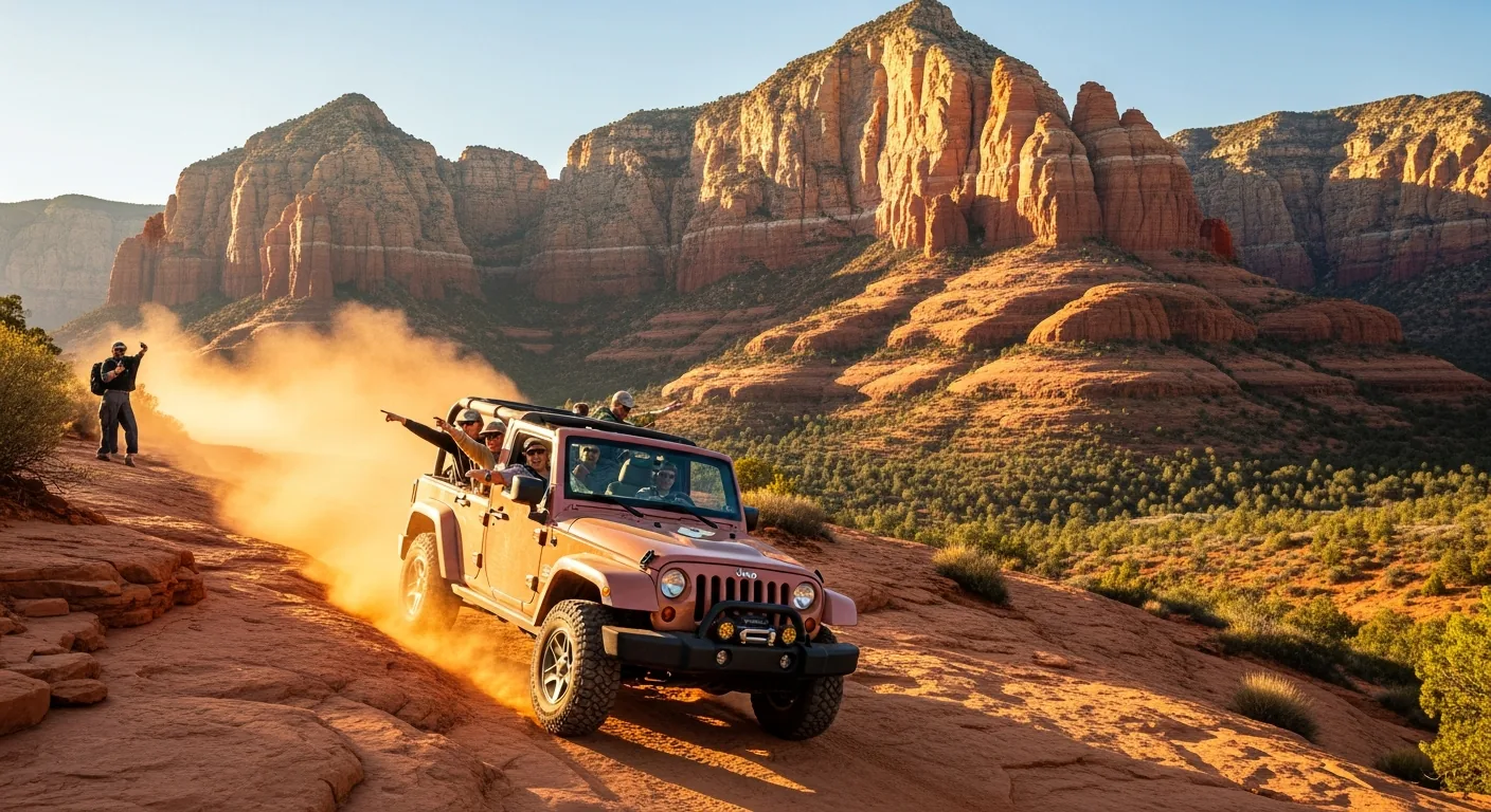
Schnebly Hill Road is one of those Sedona drives that splits cleanly into two experiences. The first stretch up to the Schnebly Hill Vista is a manageable dirt climb that most careful drivers can handle to a point, ending at one of the best red rock overlooks in the area. Past the vista, though, the road turns into a genuinely rough, rock-strewn 4x4 route that has chewed up plenty of rental cars — and that’s exactly why most visitors are better off climbing aboard a guided Jeep tour and letting someone else worry about the rocks.
What Schnebly Hill Road actually is
Schnebly Hill Road (Forest Road 153 in the Coconino National Forest) is a roughly 11-mile dirt road that connects Sedona to Interstate 17 by climbing up and over the rim of the canyon. It starts on the east side of Sedona, just past the bridge over Oak Creek, and climbs steadily through red rock country up onto the higher, pine-covered plateau near the freeway. It’s not a smooth scenic byway like the paved Red Rock Scenic Byway down by Bell Rock — this is a backcountry forest road, and it’s been one since long before Sedona was a tourist town.
A few things make it worth the effort:
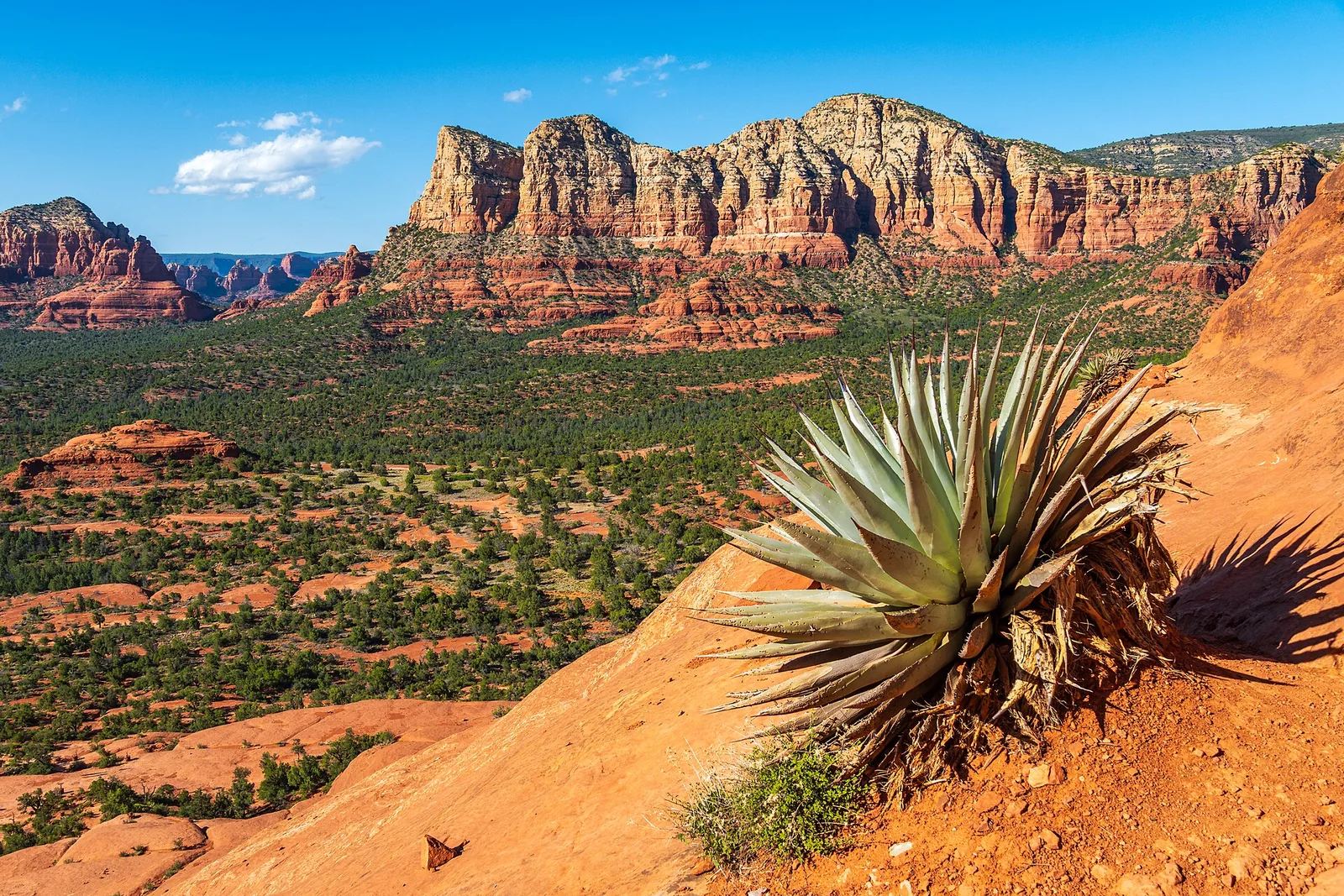
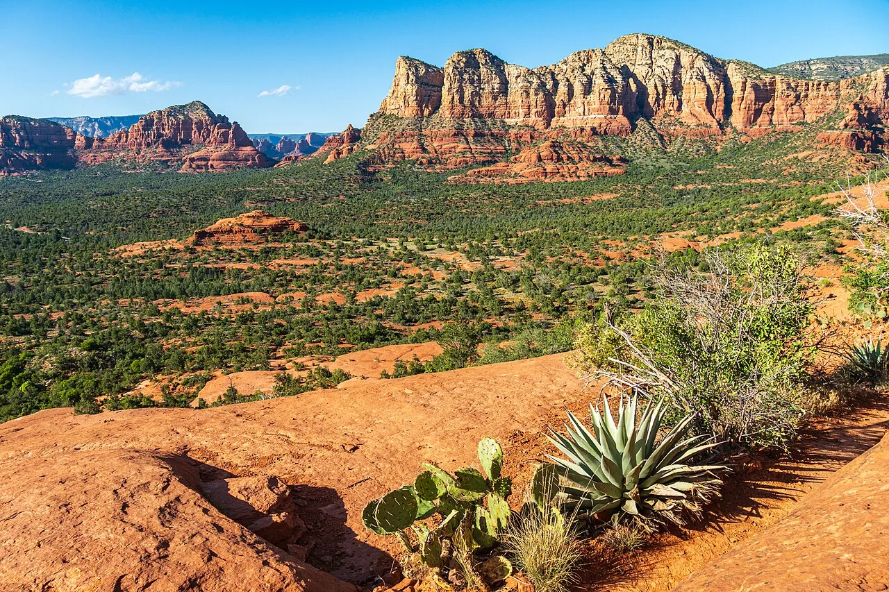
- The Schnebly Hill Vista, a Forest Service overlook partway up, gives you a sweeping view back over eastern Sedona, Bear Wallow Canyon, and out toward the Verde Valley. It sits at around 6,000 feet, well above the town.
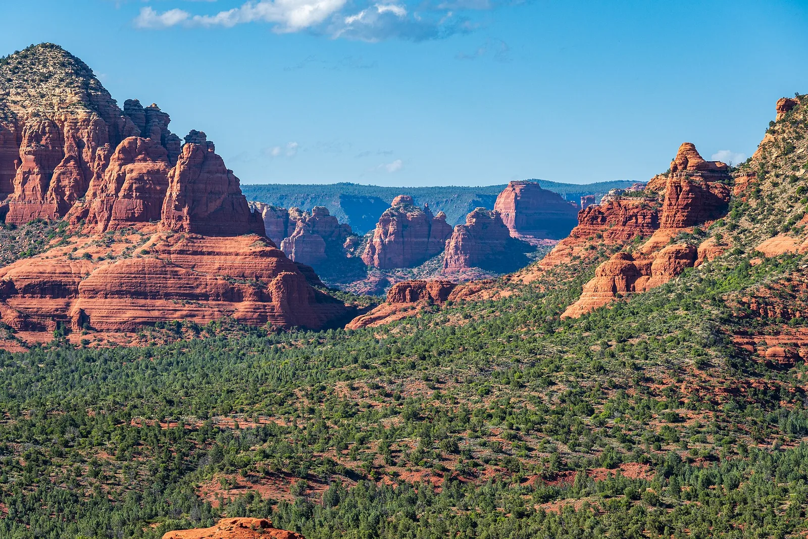
- The red rock formations along the way are some of the most dramatic in the region — Mitten Ridge, the Cow Pies, and the well-known Merry-Go-Round Rock, a flat, layered formation that’s a favorite stop for Jeep tours and photographers.
- The history is real. This corridor has been a route up the rim for well over a century, and the road carries the name of the family that gave the town its name.
It is not a hidden secret. On a nice day the lower section sees a steady stream of Jeep tours, off-roaders, mountain bikers, and hikers, and the road can get dusty and washboarded. Go in expecting a rugged shared road rather than a quiet wilderness drive, and you’ll enjoy it for what it is.
A little history (and why it’s called that)
The route up this part of the rim is older than the town. In the late 1800s, a rancher named Jim Munds used a rough trail here to drive cattle from the Verde Valley up to higher pastures. By 1902, with funding from Coconino County and help from local fruit growers and ranchers, that cattle track was improved into the Munds Wagon Road — a way for Oak Creek and Verde Valley homesteaders to haul produce and livestock up to the markets in Flagstaff. That old wagon route still exists today as the Munds Wagon Trail, a hiking and biking path that parallels the lower part of the modern road.
The road you drive now, Schnebly Hill Road, was built in the 1930s and named for T.C. and Sedona Schnebly, the early settlers whose general store and post office anchored the young community. T.C. named the town’s first post office after his wife, Sedona, in 1902 — so when you drive Schnebly Hill Road up to the Schnebly Hill Vista, you’re standing on a piece of the town’s founding story. It’s a nice bit of context to share with whoever’s in the car with you.
The two halves: vista versus the rough road
This is the single most important thing to understand before you go, so here it is plainly. Schnebly Hill Road is really two different drives, and the difficulty jumps sharply at the vista.
| Section | Surface | Vehicle | What to expect |
|---|---|---|---|
| Sedona to the Schnebly Hill Vista | Short paved start, then graded but rough dirt; a shelf road in places | High-clearance recommended; some careful drivers take it slow in a regular car | Steep climbing, washboard, ruts, narrow shelf sections, big views |
| Vista to Interstate 17 (FR 153 top) | Rocky, rutted, eroded 4x4 road | High-clearance 4WD only (or a Jeep tour) | Embedded rocks, washouts, slow going — two-plus hours end to end |
The first three-quarters of a mile out of Sedona is deceptively easy — it’s paved from the roundabout. Then the pavement ends and the road becomes a rough, rutted dirt climb, with stretches where it runs as a narrow shelf along the canyon wall. With patience and a high-clearance vehicle you can usually reach the Schnebly Hill Vista, which is the goal for the vast majority of visitors. Many people in ordinary cars do creep up the lower section, but it’s hard on a low vehicle, and a wet or freshly washed-out road can stop a regular car well short. If you’re in a rental sedan, know that most rental agreements specifically prohibit driving on unpaved roads — so you’d be on the hook for any damage.
Beyond the vista, the road keeps climbing toward the top near I-17, gaining roughly 1,800 feet from the Sedona end up to the Munds Mountain plateau — about 2,200 feet of total elevation gain over the full 11 miles. This upper half is where it earns its reputation. Recent conditions reports describe deep ruts, embedded rocks, and badly washed-out sections — drivers have noted culvert covers standing a foot or more above the eroded roadbed, and many off-roaders recommend oversized tires for the worst stretches. This part is for high-clearance four-wheel-drive vehicles with a driver who knows how to use them, or for a guided tour. It is not the place to test a stock SUV on its first off-road outing.
A realistic time budget helps set expectations. Reaching the vista from Sedona and coming back down is usually an hour to ninety minutes of actual driving once you account for stopping to take in the views and pulling over to let tours pass. Running the whole road through to I-17 is a different commitment — plan on two-plus hours one way at a crawl, and remember you’ll come out on the freeway near the rim, not back in town.
Why a Jeep tour is the right call for most people
I’ll be honest: for most visitors, the smart move is to skip driving the rough part yourself and book a Jeep tour. Here’s why.
- Your rental probably isn’t allowed up there. Standard rental contracts ban unpaved roads, and Schnebly Hill will bottom out and scrape a low car. A tour sidesteps the whole problem.
- You get to look at the scenery instead of the road. When you’re the one driving a shelf road with drop-offs and embedded rock, your eyes are glued to the next ten feet of dirt. A tour lets you actually take in Mitten Ridge and the Cow Pies.
- The guides know the history and the formations. A good guide will point out Merry-Go-Round Rock, explain the geology, and tell you the Schnebly and Munds Wagon Road stories without you having to read a single sign.
The longest-running operator in town is Pink Jeep Tours, which launched the first Jeep tour in Sedona back in 1960 and runs a route up Schnebly Hill Road. Other established outfits in the area run rim and backcountry trips as well. Tour prices and schedules change with the season, so check current rates and availability directly with the operator before you book — and reserve ahead in spring and fall, when the popular tours sell out. If you’d rather compare your options, our jeep tours guide breaks down the main operators and routes.
Getting there, parking, and passes
The Sedona end of Schnebly Hill Road is easy to find. From the “Y” — the junction of State Route 89A and State Route 179 in central Sedona — head a short distance toward the SR-179 bridge over Oak Creek; Schnebly Hill Road turns off to the east just across the bridge. Within three-quarters of a mile the pavement ends and the dirt climb begins.
A few practical notes:
- The Huckaby Trailhead sits near the start of the road and is a common place to leave a car if you’re hiking the Munds Wagon Trail or the lower section. Like most developed trailheads in Red Rock Country, it falls under the Red Rock Pass program, and its lot is modest — it fills early on busy spring and fall mornings, so an early arrival saves you circling.
- There is no large developed parking lot at the vista itself. It’s a roadside observation site with limited room to pull off, which is another reason early or off-peak timing pays off — there isn’t space for a crowd of vehicles up there at once.
- You can also reach the vista from the top. Take Interstate 17 to the Schnebly Hill exit (Exit 320) and drive in from the freeway side. That approach is still a rough forest road, so the same high-clearance 4WD caution applies — but it’s an option if you’re coming from Flagstaff.
Do you need a Red Rock Pass?
This trips people up, so here’s the rule of thumb. The Red Rock Pass is required to park at developed Forest Service trailheads and day-use sites in Red Rock Country (such as the Huckaby Trailhead). At last check it runs about $5 per day, $15 per week, or $20 for an annual pass, and an America the Beautiful federal pass is accepted in its place.
However — and this is the helpful part — a pass is not required for a quick, incidental stop to take a photo or enjoy a scenic vista (roughly 15 minutes or less). So pausing at the Schnebly Hill Vista to take in the view doesn’t, by itself, require a pass. If you’re parking at a trailhead to hike, display a Red Rock Pass or America the Beautiful pass. You can pick one up at the Red Rock Ranger District visitor center, at many local shops and self-serve machines at trailheads, or online before you arrive. Prices and rules can change, so confirm current passes and fees with the Coconino National Forest before your trip.
Local tip: Buy a weekly Red Rock Pass on day one even if you only think you’ll do Schnebly Hill. Almost every trailhead in Sedona — Soldier Pass, Devil’s Bridge, Bell Rock — uses the same pass, and the weekly rate pays for itself by your second stop. Keep it on the dash and you’ll never be the person hiking back to feed a machine.
Best time of day and season
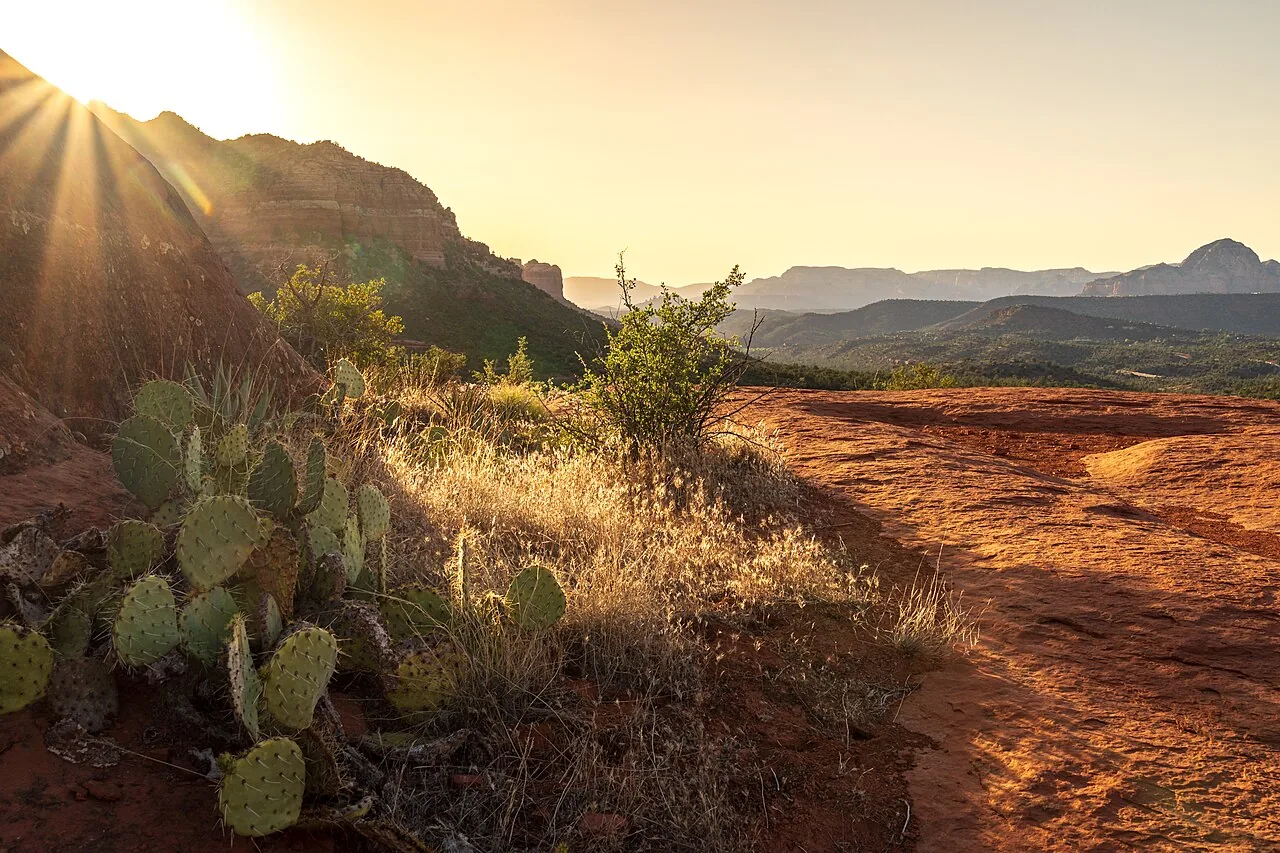
Time of day. Early morning and late afternoon are the winners here, both for light and for comfort. The red rock formations along the lower road glow warmest near sunrise and in the last hour before sunset, and the road is far quieter at those edges of the day. Midday is the busiest stretch for Jeep tours and the harshest light for photos. If you’re driving yourself, an early start also means fewer vehicles to pass on the narrow shelf sections, which makes the whole thing less stressful.
Season. Spring (March–May) and fall (September–November) are ideal — comfortable temperatures, generally dry roads, and the best all-around conditions. The Forest Service itself notes the main vista is at its best roughly April through November. Summer brings real heat in the lower section and the Arizona monsoon (roughly July through September), when afternoon thunderstorms can wash out the dirt road fast and turn it slick and rutted. If you’re going in summer, go early and watch the sky.
Winter closures matter here
This is the seasonal detail that catches people off guard. The upper portion of Schnebly Hill Road is closed in winter — typically from around December through April — because of snow and ice up on the higher plateau. The closure generally runs from the Merry-Go-Round area up to the top near I-17, and access from the Huckaby Trailhead side can be affected too. In other words, in the dead of winter you may be able to reach the lower formations but not drive through to the freeway, and the vista may be snowbound. There are no fixed annual dates — the Forest Service times these closures each year based on weather and road conditions, so they shift season to season. Check current road status with the Coconino National Forest’s Red Rock Ranger District (you can call them at 928-203-2900, or look up FR 153 on the forest’s online Forest Roads Status page) before you count on the road being open.
Hiking or biking the corridor instead
If the rough drive doesn’t appeal — or you’d rather earn the view under your own power — the old wagon route gives you a way to experience the same red rock corridor without a 4x4.
- Munds Wagon Trail (No. 78). This is the historic wagon road on foot. It runs about four miles one way from the Huckaby Trailhead area up toward the upper road, with roughly 1,200 feet of gradual elevation gain. It’s rated moderate, crosses and parallels Schnebly Hill Road several times, and delivers the Mitten Ridge and Cow Pies views without the white-knuckle driving. Most people turn around partway; you don’t have to do the whole thing to get the scenery.
- Cow Pies and the Hangover loop. Branching off this corridor are some of Sedona’s most famous slickrock routes. The Cow Pies are an easy, flat slickrock spur, while the Hangover Trail is a serious cliff-edge route — a double-black-diamond mountain bike line and an exposed hike that’s only for confident, experienced riders and walkers. Don’t wander onto Hangover casually; it has real drop-offs.
For more on what the local trail network offers, our mountain biking guide covers where to ride by skill level, and the broader easy hikes roundup points to gentler options if a full slickrock day isn’t your thing.
What to bring
Whether you’re driving yourself or riding a tour, pack for a rough, dusty, high-desert outing:
- Water — more than you think. It’s dry and often hot. Bring a bottle or two per person even for a short drive.
- Sun protection. Hat, sunglasses, and sunscreen. The exposed overlooks have no shade.
- A bandana or buff. The road is dusty; tours in open Jeeps especially kick up a lot of it.
- Layers. The vista at 6,000 feet can be noticeably cooler and breezier than town, especially morning and evening.
- A real camera or a charged phone. The views back over Sedona are the whole point.
- Sturdy shoes if you plan to walk out onto Merry-Go-Round Rock or any of the formations — the slickrock is uneven.
If you’re driving the rough upper road yourself: air down your tires a bit for traction, carry a spare you trust, bring recovery basics, and don’t rely on cell service up there — it’s spotty to nonexistent in the canyon.
Photographing the drive
Schnebly Hill is one of Sedona’s best photo runs, and a little planning makes the difference. The classic shot is the view back over town from near the vista, which works best in the morning when the sun is behind you and lighting the red rock face-on; by late afternoon that same view falls into shadow while the formations across the canyon light up instead. Merry-Go-Round Rock photographs well in side light early and late, when the layered ledges throw shadow and texture. Build in a few extra minutes for grit management — the constant dust is hard on lenses, so keep your gear bagged between stops and bring a cloth. And because the road is narrow with limited pullouts, frame your shots from the pullouts rather than stopping in the travel lane; tours and off-roaders need the room. For a wider list of where to point a camera around town, see our photography spots guide.
Accessibility
Be realistic here. Schnebly Hill Road is not an accessible destination in the usual sense — it’s an unpaved, rutted forest road with no developed walkways at the formations. That said, the Schnebly Hill Vista is a defined Forest Service observation site you can reach by vehicle, so the view itself can be enjoyed from at or near the parking area without a hike, which makes it one of the more reachable big-view overlooks if someone in your group has limited mobility. The catch is getting there: the drive up to the vista is rough enough that a guided Jeep tour, where someone else handles the road, is often the most comfortable way for travelers who can’t or don’t want to drive the dirt themselves. Open-air tour Jeeps do require stepping up into a high vehicle, so ask the operator about seating and assistance when you book.
How to avoid the crowds
Schnebly Hill isn’t as mobbed as Devil’s Bridge, but the lower section and the vista do get busy with tours and off-roaders. A few ways to dodge the worst of it:
- Go early or late. A sunrise start beats both the heat and the Jeep-tour rush; the last couple of hours of daylight are quieter too.
- Avoid midday. That’s when the bulk of commercial tours are running the lower road.
- Skip weekends and holidays if you can. Saturdays in spring and fall are the busiest by far.
- Use the freeway approach (I-17 Exit 320) if you just want the high country and the vista from above — it sees far fewer casual visitors than the Sedona end.
Safety
A rough mountain road deserves a little respect. Keep these in mind:
- Drive within your vehicle’s limits. If you’re not in a high-clearance 4WD and you hit rock or deep ruts, turn around. There’s no shame in it, and it’s a lot cheaper than a tow off a forest road.
- Mind the shelf sections. Parts of the lower road run as a narrow shelf with drop-offs. Use pullouts to let faster traffic and tours pass, and don’t crowd the edge.
- Watch the weather. Monsoon storms can wash out the dirt road and flood low spots quickly. If thunderheads are building, don’t commit to the upper road.
- Tell someone your plan. Cell coverage is unreliable in the canyon. Let someone know your route and rough timing.
- Carry water and a basic kit. Heat is the real hazard out here. Even a short breakdown is more pleasant with water, shade, and a hat.
- Respect the closures. If the upper road is gated for winter, don’t try to drive around it — those gates are there because of ice and snow you can’t see from below.
What to pair it with nearby
Schnebly Hill works well as part of a bigger day on the east side of Sedona. A few natural pairings:
- The Munds Wagon Trail / Schnebly Hill Trail — the old wagon route runs alongside the lower road and makes a good hike or mountain bike ride if you want to experience the corridor on foot or two wheels.
- A different scenic drive. If you want a smoother, paved counterpart, the Red Rock Scenic Byway past Bell Rock and Courthouse Butte is the easy classic, and the Oak Creek Canyon drive up SR-89A toward Flagstaff is the lush, shaded one.
- Uptown Sedona sits right at the foot of Schnebly Hill Road, so it’s easy to grab a coffee or a meal before or after — handy whether you’re heading up early or coming down dusty.
- More overlooks. If you’ve caught the view bug, our roundup of the area’s best sunset spots will point you to a few more places to end the day.
And when you’ve had your fill of dust and washboard, the nice thing about basing yourself nearby is the soft landing at the end of the day. After a rough morning bouncing up to the vista, there’s something genuinely satisfying about getting back, rinsing off the trail, and squeezing in a few rallies on the indoor court at the house before dinner — climate-controlled, no dust, no crowds. If you haven’t already, you can stay at Pickler House and make that part of the trip.
The short version
Schnebly Hill Road gives you a real backcountry red rock experience and one of the best overlooks in Sedona — but it’s a rough road that gets serious past the vista. Drive the lower section carefully if you have a capable, high-clearance vehicle and you’ve checked the road is open; otherwise, book a Jeep tour, leave the rocks to a pro, and spend your attention on the scenery and the story instead of the steering wheel. Either way, go early, bring water, mind the winter closure, and you’ll come away with the kind of views that make Sedona worth the trip.
Frequently asked questions
Can I drive Schnebly Hill Road in a regular car?
Do I need a Red Rock Pass for Schnebly Hill Road?
Is Schnebly Hill Road open in winter?
How long does it take to drive Schnebly Hill Road?
Is a Jeep tour worth it for Schnebly Hill Road?
Stay where you can rally any season
Sedona Pickler is a private West Sedona vacation home with its own indoor, climate-controlled pickleball court — a short drive from the trailheads, viewpoints and restaurants in this Sedona guide. Play at sunrise or after dark, in any weather.
Check availability on Airbnb